Conrad and I have been exploring and researching the Folsom Lake/American River area. Now is the perfect time to do so because the lake level is VERY low. We are currently able to see structures, dams, roads, and ditches that were constructed during the olden days of panning for gold.
We're in the parking lot readying our gear ...
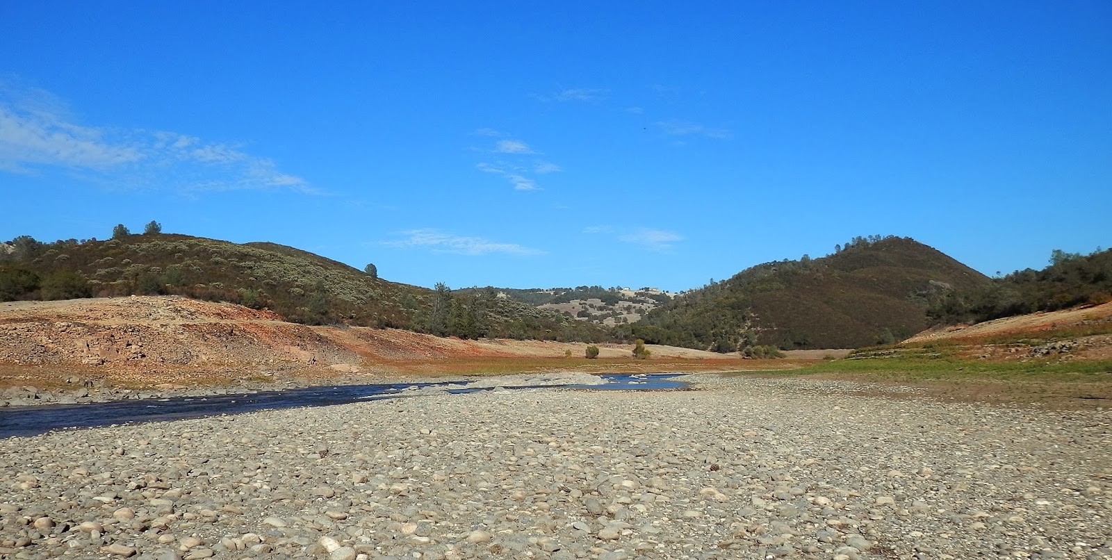
First view of Hidden Bridge ...
Zoomed in a bit with my trusty Olympus Sz-12. I love that little camera!
We're doing a "selfie" at the beginning of the hike. We do a lot of these ...
Autumn is definitely here, but you wouldn't know it by the temperature and all the sunshine!
Conrad's standing on Natomas Ditch.That, and Negro Ditch are what we are here to see. See the tree line in the far off distance? That's the water line when the lake is at full pool. It's down about 60 feet right now.
Lots of Canada Geese around. Lots.
I've never seen this part of the river/lake when it's full, but I will come back in Spring and see how different it is.
This is the Natomas Ditch. It's greatly filled in with silt and rocks, but it's pretty easy to follow ... For now ...
Also part of the ditch. Basically a shallow wall to hold the water in as it slowly descends to Folsom.
An old water wheel. Not sure when this was added, but definitely later. You can now see Salmon Falls Bridge off in the distance. We'll cross it soon.
A lock. This was used to divert the flow of water.
Conrad has located the diversion dam. It's amazing how well constructed these things are considering how primitive the area was at the time.
A BEAUTIFUL Autumn day!
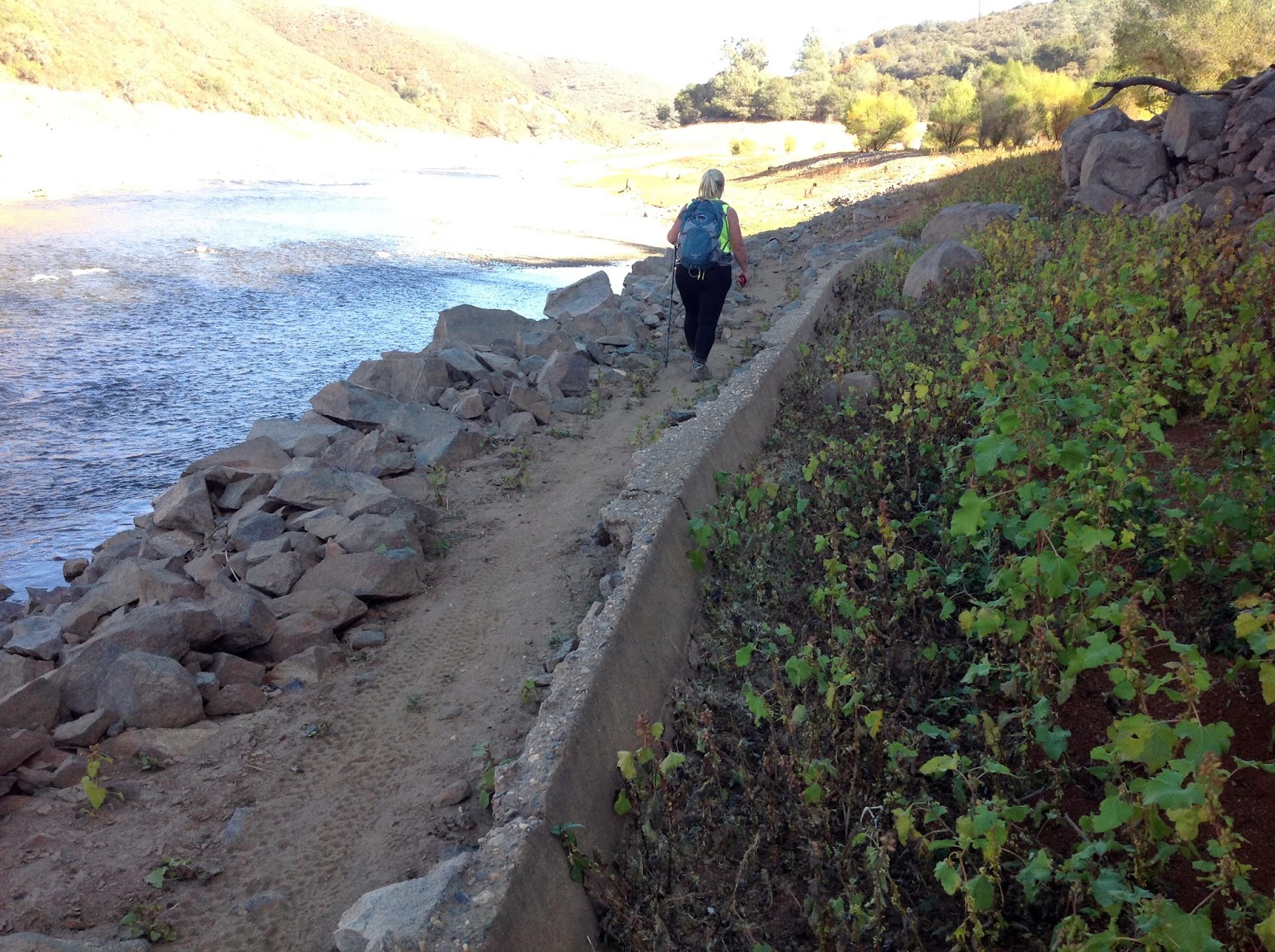
We've made the climb up the rocks to get to the bridge.
Now we're on the north side of the American River and are about to make the 3.5 mile trek back to our car.
Okay, so it was quite rough, rugged, rocky and treacherous, so I put my camera away. Conrad shot some using his iPad, so I will add them below.
As we approach the end out our hike, so does the sun approach the end of it's day.
Hidden Bridge.
One last display of vivid colors before saying good night ...
An absolute stunning day.
Here's Sweetwater Creek. We have to cross it, then we're less than a mile away from the car.
~~~~~~~~~~~~~~~~~~~~~~~~~~~~~~~~~~~~~~~~~~~~~~~~~~~~~~~~~~~~~
And now for Conrad's photos ...
Sweetwater Creek Dam
I'm ready for the adventure. I didn't have time to change clothes after an hour of Zumba, so here I am!
A close up of the construction of the diversion dam. Unbelievable.
There I go ... Trekking across the rocks ...
Salmon Falls Bridge as seen from the shoreline on the south side of the American River.
We've turned into true mountain goats today!
This is part of Negro Ditch. Some serious construction happened here!
WHEW! We've made is over lots of rocks and boulders!
The road ahead loots more inviting, though rocky.
The ditch.
An interesting placement of rocks? Who did it? When? We have no idea, but I pulled out my compass and it's spot on!
Part of an old motercycle, perhaps?
The south side of Hidden Bridge. Even after being underwater for the better part of the last 60 years, this appears to be the only damage.


No comments:
Post a Comment